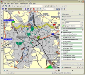
OptiNet II is a powerful GIS and data analysis system for company dealer networks management and optimization. It is designed for company sales departments and helps in finding the best places for dealers' locations within certain territory, and defining the area for each dealer. OptiNet II employs several criteria for such an optimization process. These criteria include the optimal form of the proposed regions, the low cost land renting, the minimal time needed to reach a dealer center etc. The system combines a state-of-the-art cartography system and a simple point-and-click MS Windows based user interface.
The main functions of OptiNet II are:
- User-friendly cartography data representation, including:
- Multiple layers data visualization (including zooming, scrolling etc.);
- Getting objects information using point-and-click approach;
- Showing the legend for all the object on the map;
- Maps printing.
- Interactive data analysis:
- Changing objects properties (changing area size, dealer location etc.), and observing the changes in the objects parameters;
- Printing dealer area reports;
- Showing potential residents, their most probable movement direction and a number of analysis methods.
- Data optimization:
- Combining a number of areas into a smaller number of areas (aggregation);
- Defining the best places for dealers' locations in each area, obtained as a result of the aggregation (minimizing the time needed for potential customers to get to the location either by streets or by air lines). This optimization can optionally note the land prices information.
The system is built using client-server architecture that offers multi-user mode of management of the same data and consists of following main components:
- OptiNet II Client - workstation of the dealer network operator;
- OptiNet II Management Console - workstation of the dealer network manager;
- Optinet II Server - server side application;
- OptiNet II Data Tool - workstation of the data engineer.
The system support various types of the analysis of cartographic and statistical information that allows fundamental analysis of a dealer network state as well as its optimization, such as:
- Thematic maps - ones are intended to display various information about objects on a map and to facilitate the analysis and optimisation of a dealer network;
- Reports - intended for obtaining a hard copy of the diverse information about objects and providing compatibility with existing paper/electronical document flow within the organization;
- Customer paths - intended for discovering the best driving route of the customer on a map. The best customer route is based on detailed information of road networks.
- Optimal office position - intended for finding the optimal position of office within the specified area. The optimal position of office is determined using varios sophisticated analitical techniques.
The geometry and topology data are stored using optimize data structures on the central database server that allows processing of very huge amounts of data and support collaborative usage.
The system supports data interchange with various popular GIS systems, such as MapInfo and ArcView and OpenGIS. As the input data arrive from other automatic systems there are support of conversion standard formats to the internal format of the system as well as data structure adjustment. Data structure adjustment is carried out on the basis of template of selected layer type.
The system offers high-quality printing of various maps (with polygraphy quality) as well as sophisticated point of interest (POI) searches based on intelligent geocoding functionality.
Data processed by the system may be published on the Web using built-in Web server support.
Flexible and open architecture of the system allows consider it as a basic platform for building custom GIS solutions.
